
Here are some photos of PEI
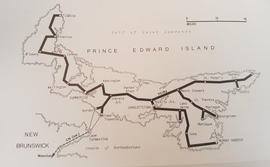
The famous railway system which was built as a condition for the colony of PEI to join Canada in 1873. This required a Constitutional amendment. In 1989 the entire system was dismantled as not being practical and too expensive to operate. What use to be the railway track was converted into a trail and now you can literally walk or bicycle the long lenght of the Island. At Borden in 1997 the new Sea Bridge was built joining the Island to the mainland at Cap Tormentine.
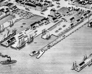
An old map of Charlottetown showing the docks area. You can see a ferry coming towards the Y shaped wharf at the foot of what is today Prince Street. There are no more ferries docking in that area and the building has been converted into a popular restaurant with great views of the Harbour.
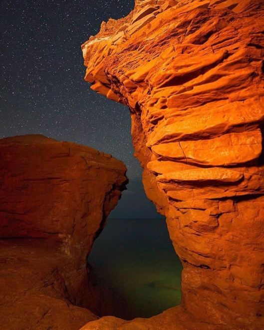
Rock formations found by the beach in PEI in the famous red sandstone with starry night sky.
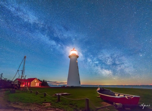
My favourite lighthouse at Point Prim, signalling the entrance into the harbour, built in 1845 by Isaac Smith. The lights on the far shore is Nova Scotia. In the comments below, sailstrait.wordpress.com who has a wonderful blog on PEI brought some very useful information about this lighthouse. Have a read it is worth it. http://www.peilighthousesociety.ca/lighthouse.php?id=29
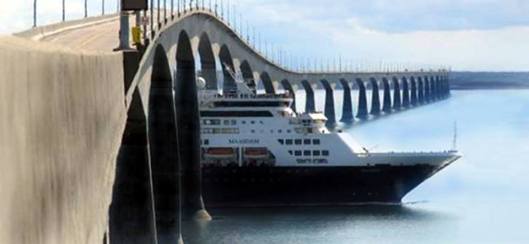
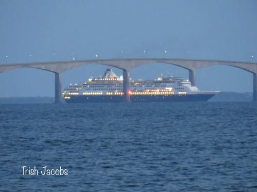
Speaking of the Confederation bridge celebrating its 20 Anniversary this year. This photo show a Holland America Cruise ship passing under the central arch of the bridge on its way to the Gulf and the Saint-Lawrence River.

👍
LikeLike
Ça me met dans l’ambiance; j’ai bien hâte d’y être (3 sept.)!
LikeLike
What variety!
LikeLike
Dear Laurent;
I am writing with reference to your statement that the Point Prim lighthouse was built for Samuel Cunard. I remember seeing this statement in one of your earlier postings and meant to write at that time but now the error has been repeated. Ordinarily this might not trouble me but as your site is widely read and may serve as the source for other postings I think it is important to insert a correction. While Cunard, as a ship owner and merchant, would have had an interest in seeing a lighthouse built, it was most certainly not built for him. It was built pursuant to a decision of the P.E.I. legislature which passed legislation and provided the funds. They were no doubt influenced by petitions from the Directors of the P.E.I. Steam Navigation Company and from a group of merchants and ship owners but the move was widely supported for the good of the colony and not for the benefit of Cunard specifically. The P.E.I. Lighthouse society’s page at http://www.peilighthousesociety.ca/lighthouse.php?id=29 contains additional information.
Neither Samuel Cunard nor his brothers Joseph or Edward ever lived on Prince Edward Island although they had large land holdings (estimated at up to 1/6 of the Island) there. Samuel’s daughter, Mary, married James Horsfield Peters who became Cunard’s land agent on the Island. They built Sidmount House in Charlottetown which still stands, albeit hardly seen as it is surrounded by suburban residences.
LikeLike
Hello, Thank you for your clarification on this matter it is most appreciated. I will correct it, tout de suite. The other point about Mary her husband is also very good, as I was told that the house in question was for Cunard’s son and had no other information. Always useful to know, thank you for taking the time to write this.
LikeLike